Monday, December 15, 2008 |
|||
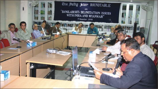
"Why should 'equidistance' be imposed on Bangladesh?" A seminar on, “Bangladesh's Delimitation Issues with India & Myanmar” was held at The Daily Star conference room on 19 Nov 2008. It was participated by retired foreign service and military officers. Excerpts of the proceedings are listed below.
Mahfuz Anam We want to be a more informed nation, more professionally equipped country. We would urge you all to help us clarify these issues. Why are we having this conflict with Myanmar? One could be that there is vagueness; there are loopholes that are being taken advantage of. If this is the case then what sort of support we can give from media. Can we create right kind of public opinion without resorting to jingoism? We are very firm on protecting our national interest. I would now request Brig Anam to moderate the discussion. Brig. Gen (Retd) S A Khan We would like to start with a brief presentation by Commodore Khursheed which I hope will put us all in the same grid in so far as maritime issues are concerned, and briefly touch on the UNCLOS. Later, I would request the participants to briefly comment, only add facts or correct errors. After that I would like to go to UNCLOS itself and request our legal expert Barrister Haroon ur Rashid who was involved in it from the beginning of UNCLOS, to brief us on the legal aspects, how did we proceed in addressing the issues that are involved in UNCLOS. There are two datum lines as far as UNCLOS is concerned, vis a vis Bangladesh. One is 1994 and the other is 2001. We can discuss how things proceeded, where did we stumble, why did we stumble, if at all. We will go on to the Myanmar position on delimitation, and then discuss the Indian position on delimitation. We will then go on to the Bangladesh position on delimitation after which we will touch upon the recent incident with Myanmar and the various issues that are involved including the fact that they have been in this area for the last five years. We have had no dialogue with India on this issue since 1980, and with Myanmar since 1986. At the end we shall talk about maritime security and how we shall go about addressing the issue of maritime security. I now request Commodore Khursheed to make his presentation. Commodore Khurshid has written a book entitled 'Bangladesh Maritime Challenges of 21 Century'. It is first of its kind in Bangladesh. Cdre (Retd) M Khurshed Alam Not many of us in Bangladesh know why Vasco de Gama came to India in 1492. It is only because of the law of the sea. Two years later, in 1494 when Christopher Columbus went on his first expedition to America, Pope John Paul - VI called the then two major maritime powers of the world, Spain and Portugal, and divided the seas between them. He gave Spain the North Atlantic and Portugal the South Pacific and Indian Ocean.
All these four conventions came into force by 20 March, 1966 but the only thing UNCLOS could not decide was what should be the territorial sea limit as it was three-mile limit widely accepted because of the Dutch jurist Cornelius. It generated a debate but they could not take any decision. And that is why there was UNCLOS-2 in 1960 only to decide how to delimit the territorial sea. And there was a proposal that territorial sea should be six miles from the coast line and six miles partially exclusive fishing zone. But this was not passed because of one vote against it. As you all know that subsequently many countries got their independence. And they were voicing concern that in the UNCLOS of the fifties and sixties their problems and their concerns were not taken care of. By 1967 many of the countries, especially Malta raised this issue in UN General Assembly to have another law of the sea. By that time 25 nations were taking 3 nautical miles as territorial sea, 66 nations were taking 12 miles as territorial sea and 8 nations including America taking 200 miles as territorial sea. Subsequently, in 1970, the proposal was adopted in the General Assembly and from 1973 the drafting of the new law of the sea or the third UNCLOS commenced. It finally ended in 1982. On 10 December 1982 it was open for signature and 19 countries signed the convention. According to the convention when the 60th instrument will be deposited to the UN, the law will come into force. And it came into force on 16 November, 1994. Except of course Part 11which was about sea bed mining, which the developed countries did not agree to sign as it was passed in 1982. Subsequently that also came into force on 20th July 1994. A little update on the UNCLOS. Till today, 155 countries have ratified the law of the sea and 132 have ratified Part 11. What is there in the law of the sea? First of all, it is important for drawing a base line. Because, subsequently all the maritime zones will be calculated on the basis of this base line. To draw the base line there are two basic principles: one is the low water, that is, wherever the water on a beach recedes will be the place to draw the base line from. And another one is straight base line beginning from the low water line to low water line. Unstable coast line like that we have in Bangladesh can also have straight base line but that must start at some point on the land finishing at some point on the land.
For continental shelf the UN has a separate body called Commission on the Limits of Continental Shelf. There each and every country has to submit their claim within 10 years of their ratification with relevant data of survey. There is another maritime zone called high sea where all the freedoms are there but that starts after EEZ. There is also provision for settlement of maritime disputes. We can go to International Court of Justice. In addition there are three others: International Tribunal for the Law of the Sea; Arbitral Tribunal, and Special Arbitral Tribunal. These are embodied UNCLOS 3. This is the background of the law of the sea. Under this law what has Bangladesh done so far? Bangladesh, in 1974, enacted Territorial Water and Maritime Zone Act in parliament. And then later on Bangladesh declared 8 imaginary points at 60 feet of water. There was no such base line drawn in the world at that time. This was done when the drafting of the law of the sea was going on. From there Bangladesh also declared 12 nautical miles of territorial water from the base line. Then it declared 6 nautical miles of contiguous zone and 200 miles of economic zone from those 8 points. Also there was an article in the Territorial Water and Maritime Zone Act about the Continental Shelf. Now, what are the problems we have so far faced? First of all our problems of maritime boundary limitation is surrounding the island of South Talpatti. The border river is called Hariabhanga and the Radcliff boundary finishes somewhere inbetween South Talpatty and 24 Parganas. It said that the boundary shall follow to the Bay of Bengal following this line. In 1970-71, when Bangladesh was fighting the Liberation War this small piece of island surfaced. Although we have always said it was not an island but a low tide elevation, India, with its mighty hydrographic ships and arrangements notified the US Hydrographic Association as well as the British government that it was an island that belonged to them. They said it was a natural extension of their territory. When we declared the Territorial Water and Maritime Zone Act, India was first to protest saying that this base line intruded into their waters by about 20 nautical miles. Then in our eastern border we have delimited our maritime boundary following the Naf River. In 1974, this line and this island were joined and a midpoint was found somewhere here. And from the midpoint, the Myanmar side proposed initially about 270 then 243 degrees based on equi-distance. Both India and Myanmar have been trying to draw equi-distance line with the adjacent countries. Of course it is easier to delimit maritime boundary if the coast line is situated opposite to one another. You just draw a median line between two opposite posts. India has so far delimited maritime boundary with Maldives, with Sri Lanka, with Thailand with Myanmar, even with Indonesia. Maritime boundary problems with Bangladesh and Pakistan have not yet been solved. Bangladesh can hardly get even 200 miles of EEZ if India insists on equidistance and draws this line and Myanmar is also allowed to draw this equidistance line. We simply cannot go to Continental Shelf if both countries insist on their demands of equidistance line. In 1979 there was a line known as 227 line, which is up to 80 miles which allows some kind of access to Continental Shelf as well as EZ. But this line was also not accepted by Myanmar. The present problem which came up somewhat relates to this line because they were somewhere here during the exploration. If you look at the map of Bay of Bengal you will see there is hardly any area left for Bangladesh's Continental Shelf. Our north-south line is somewhere along 92 degrees. Myanmar side always says that if we draw a line somewhere here you can throw a stone at their posts. For Continental Shelf we have seen that sediment theory is also applicable to us but if we follow 2500 meter isobar in the Bay of Bengal then if we go hundred miles towards south it will be more beneficial for Bangladesh. But again for Continental Shelf our time limit is ten years from ratification, which is finishing on 27 July, 2011. But in the conference some relaxation have been given considering the fact that the number of submissions they are going to receive it may not be possible for the 21 judges to give the decision. Therefore, possibly we will get some more time to submit this. But we shall have to submit a framework and some preliminary data by 2011. As for Continental Shelf seismic survey needs to be carried out to find relevant data. Hopefully, the government is proceeding towards that. But not much time is left for us. Now about the problem that has come up with the oil rig. This is the 91 block. In 1974, blocks were given by the government of Bangladesh. This block near the Sundarban was given to Ashland but India wrote to their head office saying that maritime boundary has not been settled therefore even if you get oil you will not be allowed to explore. Ashland left thereafter. This is the 91 block and you can see what was offered to Myanmar in 1979, the 227 line, was maintained and these blocks were published in 1991. Here India has already given two blocks in 2006 - d-23, d-22. They have already carried out seismic survey here. Based on this line Myanmar also carried out survey here. This is where they were trying to have the drilling rig. Because of this problem most of our deep sea blocks are disputed. As a result, none of the IOCs actually submitted any bid for these disputed blocks. They submitted bids for only those very clearly area blocks, which they know will probably not on Bangladesh side. That is why without a dilineated maritime boundary it will be futile to have these areas offered to the IOCs, because there will be no more participation. This time Indian and Myanmar have been able to persuade all the IOCs not to bid in the disputed areas. I have been advocating all the time that we need a permanent body for UNCLOS. We have to redraw the maritime base line and claim the continental shelf, demarcate our maritime boundary, solve the sovereign issue of South Talpatti and we have to update our local laws and maritime zone act of 1974, explore the sea areas for gas and minerals, develop effective and modern maritime establishments in line with the law of the sea to support our diplomacy. I shall now read out two paragraphs from articles I wrote in 2006. “We can only sound the national alarm bell for our political masters to come forward and see that the possession of our rightful sea resources are not wasted by a single day and take measures to solve the maritime boundary issues.” This one I wrote in 1993. “Effective and scientific extraction and preservation of sea resources could change our lot. But are we capable of doing so? To accept this challenge we have to delimit maritime boundary and consolidate our position in the Bay of Bengal more effectively to derive maximum benefit out of it.” Rear Admiral SI Mujtaba Brig Anam Admiral Mujtaba Ambassador Harun ur Rashid In 1968 when I was in foreign office, Peru was claiming 200 miles as territorial water. The Latin American countries were claiming 200 miles as territorial waters.
Ambassador Reaz Rahman
The third and crucial point is respective positions regarding maritime delimitation between India, Bangladesh and Myanmar. In so far as our territorial jurisdiction is concerned it overlaps with that of India and Myanmar. It is only through negotiations, only through an agreement with the neighbours that we can determine our maritime boundary. Nobody else has jurisdiction in this matter. If the two neighbours cannot reach an agreement then we can have recourse to an arbitral council, we can have recourse to the ICJ, but nobody else can impose or decide on this matter, neither can Indians do it nor Myanmar can do it. There is no unilateral position. Let me make it clear here that insofar as a small country like ours is concerned, our basic recourse must be dependent on law. It cannot be dependent on military might. We are not going to have our navy compete with the Indian navy, or Myanmar navy for that matter. Of course we must have a deterrent value of our armed forces. We need to have vigilance. When we come to the issue of maritime boundary and delimitation, there are two vital elements here. It is the difference between those countries that claim that equidistance matters, and those countries that claim equity. Bangladesh claims equity as the basis of determining maritime boundary. Equidistance is a method of drawing the line where every point is equidistant on the territorial base line that leads to the drawing of that line. We do not follow that policy. We do not say this is the principle of law. Equidistance is only a method and there are many, many ways of drawing the equidistance line. So, why that should be imposed on Bangladesh? One of the most important elements is our claim on an extended Continental Shelf. In 1974, when we made the Territorial Waters and Maritime Zone Act, there was no law of the sea. We unilaterally declared our zones; as a matter of fact we declared 6 miles for contiguous zone and law of the sea declared 12 miles. The important point here is we drew a base line. The base line is the low water mark along the coast. Everybody in the world accepts that. But an exception was made to that when Norway and Sweden argued that because of a very deeply indented coast line and a fringe of islands, territorial waters should be more than 3 miles (in those days territorial waters was 3 miles). However, many of the countries argued that law of the sea should not conform to the maritime boundary only. Bangladesh came in with a totally different concept. Our concept was that we have a deeply indented coast line, that we have a delta, and that we have a coast line that is very unstable in nature, we have mud banks that appear and disappear. And the basic cut off point was that there is the limit of navigability. We drew a more or less perpendicular orientation for our maritime boundary. Another vital point is the impact of South Talpatti. In 1982 we suggested a joint survey by Bangladesh and India of South Talpatti but India said it was not a disputed island. The most important issue is our claim to an extended Continental Shelf. If we can establish our claim then we can have a much better deal on maritime boundary. Brig Anam
The second point I would like to emphasise is that with India and Myanmar there are major disparities.The two countries depend on the method of equidistance while we are depending on the definition of the Continental Shelf. This is a matter of stated law and not of equity. International law entitles you to national boundaries not to your land territory. And this has been reaffirmed by the International Court of Justice. There is another bigger disparity - which is in the stakes involved. As far as India is concerned its maritime dispute with Bangladesh involves between five and 15 percent of its maritime territory, and that is a very conservative estimate. For Myanmar, its dispute with Bangladesh involves between 10 and twentyfive percent of its maritime territory. For Bangladesh, our stake is one hundred percent. If you don't get it you are out. It is said that there is provision for going to the International Court of Justice for arbitration but this is not mandatory. Neither India nor Myanmar believes in third party arbitration. Only Bangladesh believes in it. About extended Continental Shelf I would like to say that it is a not a matter of equity but a matter of law. Brig Anam Ambassador Shafi Shami
I find that after 28 years we have not gone much ahead in solving the issues. After the recent negotiation both the delegates said they have understood each other's position better. The same thing was said 28 years ago. It appears it will be very difficult to achieve an agreement at that level. However, we must continue negotiation. Negotiation is the best possible way to resolve this issue. And perhaps political direction will come and it will take lot of courage on the part of political leadership. I think political will has to be energised, both in India and in Bangladesh. Barrister Harun Ambassador Serajul Islam Reaz Rahman Second, The Indians were supposed to submit claims for CLCS by 2004. There was blanket extension of five years. They are now supposed to submit it by 2009. I understand they are seeking further extension. There is a traffic jam with regard to the submission of claims. So the whole issue of timing has become skewed. Many countries have submitted their claim but others are biding for time. Myanmar was keen for negotiation because of the exploration but India was not pushing for negotiation on maritime boundary issue. The convention was signed in 1982 but it came into force only in 1994. A lot of activities took place during this period. Barrister Harun
Prof. Shahiduzzaman
Ambassador Zamir My suggestion is keep the institutional memory alive because that is the way to move forward. Whatever has been written by experts in their notes should be scanned and put in CDs. The next generation will be able to use that as resource base. We should try to be integrated in our approach. Cdre Khurshed Because of the delay in solving the maritime boundary issue India has declared D 22 and D 23 blocks on our declared area as theirs. They have already carried out physical survey there and probably next year they will bring in their rig here. These are inside our waters as per declaration of 1974. Myanmar also carried out survey in 2005 and possibly come back soon. They have given the block to the IOC in 2003. This block clearly encroaches into our area. We have hardly taken any action. So, by simply delaying maritime boundary delimitation whether we have done good for the country or not only future will tell. I personally feel we have done great harm by not taking right initiative at the right time to delimit our maritime boundary. About the continental shelf the question is how much preparation we have done in the last 8 years. If we have to submit claim in 2011 or even later, we have not carried out any physical survey. Equidistance is a very simple method but that is the method that has been followed in case of over 59 delimitation cases so far all over the world. On the other hand, as for equity, we have been harping as per article 73 and 74 in 1983 but which factors of equity will give Bangladesh a better advantage compared to Myanmar or India have not been identified. Ashfaqur Rahman Barrister Morshed Survey of our maritime zone has been done by a German company and also the Bangladesh Navy. But we do not have any results in hand from there. Rear Admiral Mujtaba Concluding Remarks |

 After the First World War, there were a lot of efforts to demarcate maritime boundaries because the boundaries drawn by the Pope was not accepted by Britain and other maritime powers. After the Second World War, President Truman of America declared two hundred miles of sea area through the coast line as their territory. This created a big problem. So there was a need for law of the sea and some sort of order in the sea area. That is why in 1958, first law of the sea conference was held and four pacific laws were passed. Those were high seas, territorial seas and contiguous zone, conventional continental shelf and conventional fishing and living resources of the high seas.
 What are the maritime zones given in the law of the sea? Firstly, the territorial sea extends twelve nautical miles towards the sea from the base line. Up to this line you have full sovereignty like you have on the land area. And then you have 24 nautical miles of contiguous zone again from the base line. Here you have another 12 miles from the territorial sea limit. Then you have 200 miles of exclusive economic zone calculated from the base line. Here, all the living and non-living resources of the sea belong to the coastal country that can explore, exploit and conserve as the country would like to do. After the exclusive economic zone (EEZ), we have the continental shelf that is again from the base line. It can go up to 350 nautical miles but the claim of continental shelf is not automatic like in the case of exclusive economic zone.
  In India's map South Talpatti is known as New Moore Island. There is a satellite picture which indicates that the flow of Hariabhanga River is west of South Talpatti. Probably it came to the notice of the Bangladesh government that India has trained the river upstream to divert the flow of the Hariabhanga River west of South Talpatti. If they have trained the river flow it does not mean that that the land belongs to them. We can prove to the higher authorities or the UN that this river was originally flowing on the west of South Talpatti. Bangladesh at that time had set up a lighthouse on South Talpatti and within fifteen days it was not there anymore.
  The name South Talpatti was given by us. Because Talpatti is in the Sundar-ban area so it makes a link. Low tide elevation under international law to my knowledge has no impact on delimitation. Delimitation has to be from the base line. Because everything we want to measure, like territorial waters, economic zone, continental shelf etc., what is the yard stick? Where do we measure? It is from the base line. So, whatever we call must be from the base line. That is the point that ordinary people understand. Now what is our base line? I will come to this later. Second thing, we had suggested a joint survey by Bangladesh and India in 1974-75 to see where the deep channel goes. India argued that it touches their sovereignty. If they agreed to a joint survey that would mean there was a dispute on their claim. So they have not yet agreed, in spite of our proposal. The third element is the swatch of no ground, which is a river within the ocean, a submerged river. In Paris, a scientist told me that your swatch of no ground is alive. Therefore, it is taking all the silt towards Sri Lanka. This will never rise.
  Ambassador Ashfaqur Rahman
 Another point is territorial jurisdiction. Let me make it clear here that in 2011 we are not going to determine our maritime boundary. That is not the deadline. In 2011 we are going to put forward our claim for an extended continental shelf. What is the importance of this claim? Under the law of the sea the coastal state has automatic jurisdiction over areas that have been mentioned. That means each coastal state has 12 mile territorial sea, 12 mile contiguous zone, 200 mile exclusive economic zone in which they can lay claim over living and non-living resources. The only issue is continental shelf. In some cases you are allowed to claim up to 350 nautical miles. Now Bangladesh has got continental shelf position. That does allow us to put in a claim beyond 200 miles, up to 350 miles.
 Barrister A K H Morshed
  Bangladesh's position has to be based on the strength of law. Bilateral negotiation has to be the preferred way. Basically there are three issues between India and Bangladesh with regard to base line definition of 1974, South Talpatti and Hariabhanga river and equity and equidistance method. Equidistance is easier to apply between opposite states, whereas equity comes into play in reconciling conflicting interest of neighbouring states.
  From 1982 to 2008 there was a big gap. There was no sense of political direction as far as the law of the sea or demarcation of maritime boundary is concerned. We need to be more focused and the media can clear the perception that 2011 is not the doomsday. There is no professional approach to such a crucial problem to the future of Bangladesh. We really do not know who should take the lead in these issues. Whether or not we will solve the problem with India or Myanmar will depend on the political will. The direction must come as a political solution. Therefore, professionals must build a case on the basis of the law and prepare a professional team. Today one recommendation that should be considered is that we must coordinate all our minds, we must have the best professionals in all the fields and bring them under one roof.
  Dr. A.K. Azad
 My concern is about late reporting of the presence of the exploration rig. Why wasn't it identified earlier? Why we didn't get intelligence report since we have our ambassador and military attaché in Rangoon? It shows lack of efficiency on the part of our government. I am also worried about gathering of troops across the land border. It is a military government that we are dealing with. We have to be very careful about what we can achieve through negotiations with them. Legally, our stand has not been as strong as it could have been. International pressure may apply to a certain extent but we will not have much chance of stopping either Myanmar or India from carrying out unilateral exploration. We will have to just watch and see. I think in a few months Myanmar will acquire naval ships and use force in order to ensure their work. We have never seriously contemplated alliance relationship in this context. We have to pursue alternative routes.
  Dr Uttam Kumar Dev
 It would be useful for the parliament standing committee in charge of defence or foreign affairs to seriously consider keeping such important problems in their agenda so that they can have a meaningful dialogue within the parliament.