|
Follow up
The Dam Documents
Syed Zain Al-mahmood
From the time it was first mooted in the early 70s, Bangladesh has been asking India for data on the Tipaimukh Dam project. But to the consternation of local experts, the project remained shrouded in secrecy. At a Joint River Commission (JRC) meeting in September 2005 held in Dhaka, India formally assured Bangladesh that it would share the project design. But that assurance joined a long list of unfulfilled promises regarding shared rivers. Besides, India also did not share any study report on the dam's downstream impact while going ahead with the implementation of the hydel project -- something that legal experts say is a clear breach of The Ganges Water Treaty.
Even when Shiv Shankar Menon, the Indian Foreign Secretary, arrived in Dhaka in April and requested the government to send a delegation to visit the site, information appeared to be at a premium. The foreign minister Dipu Moni told reporters some information had been obtained. Water resources minister Ramesh Chandra Sen then weighed in, saying that the information given to Bangladesh has only the dimensions of the dam and that the parliamentary team due to visit India would seek more data.
Withholding any information by the upper riparian countries regarding the use of common river waters is considered a violation of the UN Convention on International Watercourses. India is not a signatory to the convention, and may have considered it a mere nuisance. But domestic environment laws meant that the agencies implementing the project had to meet environmental standards. They had to carry out environmental impact assessments -- and make the information public.
In 2006, North Eastern Electric Power Corporation (NEEPCO) -- the implementing agency -- moved to obtain Environmental Clearance from the Ministry of Environment & Forests. To clear this hurdle, it commissioned the Agricultural Finance Corporation of Mumbai to carry out an Environmental Impact Assessment (EIA) of the Tipaimukh dam. This document was finalised in 2007, and it is in the public domain.
Although Bangladeshi water experts, not to mention the government, seemed in the dark over this, the EIA report was studied and criticised by environmentalists in Manipur, Assam and Mizoram who called it incomplete and inadequate. The Report, running to hundreds of pages, has three main volumes. Volumes 1 and 2 cover the Environmental Impact Assessment, and the Environmental Management Plan. Part Three deals with Dam Break Analysis & Disaster Management.
In the section “Impact of the Project on Environment” the EIA notes, “Average water availability at down stream for monsoon season at post dam condition will decrease by 30 per cent in comparison to pre-dam condition and there by will provide relief to down stream population from recurring flood havoc. Similarly, due to regulated flow from reservoir, the non-monsoon flow will increase by 110 per cent, which will provide irrigation benefit for rabi crop.”
The major hydrological impact of large dams is to impose on the river an artificial pattern of flow variations. The flow is typically less than the peak flow during rainy season and more than the low ebb in the dry season. Experts say the prediction of the EIA is consistent with the characteristics of such dams.
Leading environmentalist and water resources expert Dr. Ainun Nishat believes this data could be accurate. “But the report does not provide enough data on how the dam would be operated and how the turbines would be switched on and off,” Dr Ainun Nishat told the Star. “This would have a major bearing on flow patterns.”
The EIA report claims the Tipaimukh dam will help control floods. Some Bangladeshi experts agree that the dam may help control flash floods, but others have warned of worse flooding to come. “The dam and the reservoir have certain limitations,” says Dr Jahir Bin Alam, head of the Department of Civil and Environmental Engineering at Shahjalal University of Science and Technology. “The dam may control some of the annual flooding. But when there is a really big rise in water levels, the gates will have to be opened to save the dam itself. That will lead to a much bigger flood downstream.”
 The Indian report makes no mention of what bearing the 30 per cent reduction of flow will have in those years when there is no flood. However, the really problematic area is the forecast of the 110 per cent increase in non-monsoon flow. On the face of it, this may sound like a good thing. But keeping in mind the unique ecology of the Surma basin, this may be a harbinger of doom. The Indian report makes no mention of what bearing the 30 per cent reduction of flow will have in those years when there is no flood. However, the really problematic area is the forecast of the 110 per cent increase in non-monsoon flow. On the face of it, this may sound like a good thing. But keeping in mind the unique ecology of the Surma basin, this may be a harbinger of doom.
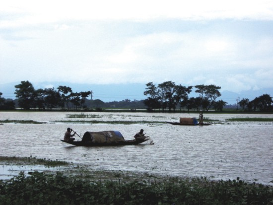
The wetlands of the Surma basin perform two crucial functions: they serve as the granaries and fisheries of the Northeast. The farmers of the wetlands depend on a single crop -- the Boro. The rice farmers plant when the water recedes in the winter, and harvest before the monsoon waters come. Because of the silt deposited by the floods, the land is extraordinarily fertile. Any artificial alteration of the “flood pulse” could affect food security and bring disaster to the region. A 110 per cent increase in dry season flow would more than double the water in the Surma and Kushiara in winter. This would mean the wetlands would not be drained, and consequently there would be no Boro.
“We have to remember this is not Rajshahi (in the north) where it is much drier. There the increase in water would be a good thing,” says Dr Ainun Nishat. “But the rivers Surma and Kushiara pass through a haor depression. An unnatural increase in river flow would cause water-logging of the haors and have a negative impact on food security.”
The threat to food security would not be limited to rice alone. The fishing community would also be badly hit. “When the water rises in the river during the monsoon, the fish go into the haors to spawn,” says Raquibul Amin, programme coordinator of the World Conservation Union (IUCN) Bangladesh. The flood not only carries fish larvae but much-needed nutrients into the haor, which turns into a vast nursery for fish. When the water recedes in the winter, the fattened fish move out into the rivers and are caught in the nets of the fishing villages lining the riverbanks. If the wetlands were waterlogged, the seasonal rhythm of the fish would be seriously hampered.
“Tipaimukh site is seismically located in Zone-V of Seismic Zoning Map of India. As per available records, about 16 earthquakes of magnitude greater than 7.0 have occurred in this region, of which 2 are of world's greatest earthquake with magnitude more than 8.5.
In view of high seismicity level, probable high intensity zone and having a high seismic risk… a detailed study is necessary before finalising structural design.”
The report clearly indicates the intention to implement another key recommendation of the Shukla Commission Report. Excerpt: “There is a proposal to construct a pick-up barrage at Fulertal, 95 km down stream of dam site, which will act as diurnal storage of 1120 cumec inclusive of power release to irrigate subsequently a gross command area of 1,20,337 ha.”
“1120 cumec is a substantial amount of water,” says Dr Ainun Nishat. “If such large amounts of water are withdrawn, then there is a possibility our rivers could run dry. It would have a disastrous effect on the livelihood of the people in the Surma basin.”
Although India has apparently “assured” Bangladesh that the barrage will not be built, analysts remain worried. “Without the barrage at Fulertal which will provide the irrigation benefits, the Tipaimukh project may not be economically viable,” commented one expert, who asked not to be named. “It may be that the Indians will offer to mitigate or take away the increased flow released from the Hydel Dam by building the Barrage at some point.”
The Tipaimukh Dam EIA Report also mentions that the “augmented flow” in the rivers would lead to the opening up of a communications channel from Kolkata to the North Eastern states. The report also forecasts that in case of dam failure, a flash flood with a height of 5.5 metres would reach the Bangladesh border.
Leading Bangladeshi experts have been critical of the EIA report, which they say do not properly reflect downstream impacts. “The river does not end at Amalsidh (Indian border),” says Dr Ainun Nishat. “Unless a comprehensive study of the effects on the Surma basin is conducted, this EIA remains woefully inadequate. I call on the governments of India and Bangladesh to form a join team of experts to study the effects of the dam on the river and the floodplains.”
Professor Jahir Uddin Chowdhury of the Institute of Water and Flood Management at the Bangladesh University of Engineering & Technology (Buet) points out that the debate on the Tipaimukh dam has so far focused on the quantity and flow of water. “But we must also keep in mind the quality of the water,” says Prof Jahir Uddin. A dam holds back sediments and nutrients that would naturally replenish downstream ecosystems. Studies of dams worldwide have shown that this has a negative impact on lower riparian agriculture and fisheries.
In recent days a minority of analysts have suggested the Tipaimukh dam could help Bangladesh by reducing floods. MA Quassem, former Director General, Water Resources Planning Organization, Ministry of Water Resources has claimed that the Flood Action Plan 6 -- a 15-year-old study -- found that a dam upstream would be useful to mitigate floods and provide benefits for navigation, irrigation, and fisheries. But this view has been debunked by other experts. “This view is not correct,” says Dr Ainun Nishat, one of the authors of the FAP-6. “The FAP was the first study to point out the possibility of water-logging in the Surma basin.”
“I cannot imagine that the study would have missed addressing the impact of the project on the eco-system, had it been so disastrous,” MA Quassem wrote in the Daily Star.
But this assertion, too, has been ridiculed by environmentalists. “The FAP6 was a long time ago,” says environmentalist Eng. Hilaluddin. “It focused on checking floods, not the environment. Absence of evidence is not evidence of absence.”
All eyes are now on the parliamentary delegation poised to visit the dam site. Even as the details of the tour are being finalised, environmentalists question whether the tour is a wise move. “We do not know what the aims of the tour are,” says Prof Muzaffer Ahmad, President of Bangladesh Paribesh Andolon, an environmental forum “We don't know what the terms of reference are. The dam has not been built yet. So we don't understand what good a visit to the site will do?”
Experts agree that the way forward is for India to make a full disclosure of technical data related to the design and operation of the proposed dam. A consensus is emerging that a joint study of the downstream impacts is necessary to fully gauge the effects on the lives and livelihoods of the 20 million people of the Surma basin. Until then, fear will continue to throw a murky shadow over Tipaimukh.
Copyright
(R) thedailystar.net 2009 |