|
On a sustainable development trajectory -- Mohammed Farashuddin Steering the economy in 2010 -- Professor Mustafizur Rahman Food Prices and Security Exploding myths, highlighting lessons -- Rizwanul Islam Rising inequality takes shine off growth --M M Akash Rural financing ~ the innovative way -- Khondkar Ibrahim Khaled Participation and representation key to pro-poor planning -- Fahmida Khatun Why list on a stock exchange? -- A.F.M. Mainul Ahsan Pushing agriculture forward -- Dr. Quazi Shahabuddin Policy choices in the FDI domain -- Syeed Ahamed Capital market window to faster growth -- Abu Ahmed Regional Connectivity-Indo-Bangla initiative -- Dr. M. Rahmatullah Foreign banks' lively role -- Mamun Rashid Why regulatory reforms? -- Zahid Hossain Energy management issues -- M. Tamim Jute bubble, lest it bursts! -- Khaled Rab Climate Change Policy Negotiations-Can Bangladesh play a leading role? -- Dr. Saleemul Huq Copenhagen and beyond --Dr. Atiq Rahman Save Bangladesh, save humanity -- Dr A. M. Choudhury For a human rights-based approach -- Dr Abdullah Al Faruque Gender dimension to policy on disaster management -- Mahbuba Nasreen Rainwater harvesting -- Dr. Manoranjan Mondal Environmental degradation and security -- Dilara Choudhury Climatic impact on agriculture and food security -- Prof Zahurul Karim PhD Monoculture destroys coast and forests --Philip Gain Towards a strong adaptation strategy -- Md. Asadullah Khan Biodiversity conservation: Challenge and opportunity -- Mohammed Solaiman Haider Grameen Shakti's renewable energy role -- Abser Kamal
|
Climatic impact on agriculture and food security Prof Zahurul Karim PhD The woes
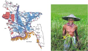
Fig. 1 Vulnerability to natural disasters Source: CEGIS Our experiences of climatic threats Floods Serious floods in the last 25 years
A large number of fisher folk lost their fishing gear and houses. The fisher communities usually live on the marginal lands of the coastal areas and were the first to experience the full force of the cyclone. The government has made an estimate of livestock losses by enumerating the number of losses in most of the affected districts. In five most affected districts some 18 percent of the poultry, 11 percent of goats and sheep, 7 percent of ducks and some 3 percent of the cattle and buffalos have been lost. In the Sundarbans some 4-5 percent (20 -25 000 ha) of forest area has been severely damaged and nearly 15 percent (60 000 ha) partially damaged. Some alien species, which had been planted in various parts of the Sundarbans on a pilot basis, have been uprooted while in the severely affected areas a large number of trees have been broken from the stem or uprooted. In the partially damaged areas many branches have been broken but the main trunks of the trees are intact. Infrastructure in the Sundarbans and elsewhere in the affected areas has also been damaged. Furthermore, some 380 km. of embankments have been washed away, which provide much needed protection from annual floods and tidal surges. Aila, 2009 Effects on water availability The increased evaporative demand due to increased temperature from climate change shall result higher crop water requirements. This will put extra pressure on already dwindling water resources of the country. About 96% of potable water and nearly 80% of irrigation water is supplied from groundwater. Temporary overdraft or mining conditions occur in many areas of the country due to extensive abstraction of groundwater for mitigating hydrologic droughts especially in dry season. In recent years groundwater levels in many areas, particularly in the north-west region experienced depletion up to 10 m from the static water level for which most of the shallow tube wells (STWs) and Hand Tube wells (HTWs) almost ran dry. Moreover, about 50,000 ponds and ditches have almost dried up. Decline in water levels of these local water bodies are due to interaction of pumping groundwater from the adjacent shallow aquifers and high evaporation losses due to climate change. Unfortunately, ground water in many places of Bangladesh is not safe and contains variable amount of arsenic. In South Western Bangladesh arsenic level in rice ranges from 0.29 microgram to 0.38 microgram per gram of rice. Much higher concentration is found in leafy vegetables (UNICEF, 2009). Arsenic problem along with climate change shall further complicate availability of water with large reduction of water during dry season. Impact of sea level rise Sea level rises will lead to submergence of low lying coastal areas and saline water intrusion up coastal rivers and into groundwater aquifers, reducing freshwater availability; damage to the Sundarbans mangrove forest, a World Heritage site with rich biodiversity; and drainage congestion inside coastal polders, which will adversely affect agriculture. Increased river bank erosion and saline water intrusion in coastal areas are likely to displace hundreds of thousands of people who will be forced to migrate, often to slums in Dhaka and other big cities. If sea level rise is higher than currently expected and coastal polders are not strengthened and/or new ones built, six to eight million people could be displaced by 2050 and would have to be resettled. It is now widely believed by experts that sea-level rise by one metre, expected to take place by the current century, will devour the whole of the Sundarbans. |
© thedailystar.net, 2010. All Rights Reserved |


 Tropical cyclones and storm surges